Advanced Internet Mapping System User's Guide
Advanced Internet Mapping System User's Guide
Introduction
This application was developed for the HTML5 environment using JQuery Mobile and ESRI's JavaScript Application Programming Interface (API). It is designed as a true cross-browser application that will function in all major desktop browsers as well as mobile devices such as smart phones and tablets.
The desktop environment provides users with tools and functionality consistent with the leading browsers used on PC and Mac machines.
- Designed and developed to work on all major desktop browsers including Google Chrome, FireFox, and Internet Explorer.
- Custom Auto Complete (predictive text) search technology provides search results with just a few key strokes.
- Printing, exporting, and report features allow users to extract information in formats that best suit individual requirements.
The mobile environment is optimized to make the best use of the smaller screen size of phones and tablets as well as leverage native GPS support of these devices.
- Designed and developed to work on all major mobile platforms including Android, iOS, and Windows 8.1 Mobile.
- Custom drawing tools allow users to annotate, symbolize, and draw graphics on the map using the touch capabilities of mobile devices.
This version of the user's guide is written for the desktop environment. User's guides for both environments are available from the Help menu at www.gcgis.org.
Application Layout
The mapping application consists of five main components. Each of these components provides tools to do certain tasks.
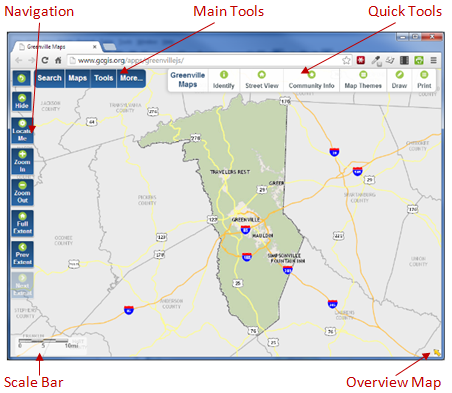
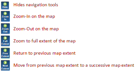
Tools used to move around in the map.
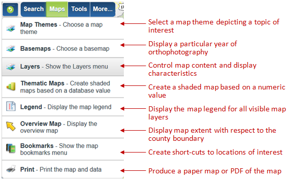
Tools to perform searches, change map content and characteristics, print, and identify features.
Search

Maps
Tools
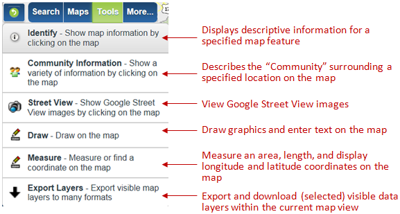
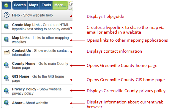
More
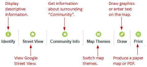
The Quick Tools menu provides easy access to frequently used tools.
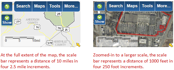
The scale bar, located at the bottom left of the map view, gives a visual representation of the scale of the map and helps determine distance on the map. Scale changes, depending on the extent of the map view. At the full extent of the map, the scale bar represents a distance of ten miles.
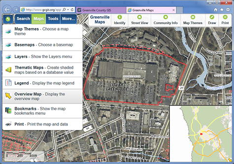
The overview map provides a frame of reference for the current map extent with respect to the County boundary. It can be accessed either by clicking the arrow in the bottom right corner of the map view or by clicking Maps, then Overview Map in the menu bar.