Welcome
Notice: Due to an ongoing software transition at Real Property Services, the Square Footage, Bedrooms, Bathrooms and Half Baths
fields in the property details may not be current. We are working to resolve this. Thank you for your patience.
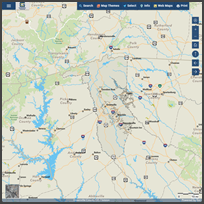
We’ve launched Greenville County Maps,
our updated mapping application
with a modern interface and improved performance. The Advanced Internet Mapping System remains available and
will continue to be supported during the transition. We encourage users to begin using Greenville County Maps for
the best experience.
Welcome to the Greenville County Geographic Information Systems (GIS) homepage. Our mission is to provide accurate and timely geographic information, system access, technical assistance, and related services to meet the needs of County operations.
County functions supported by GIS include real estate tax assessment, law enforcement/crime analysis, economic development, voter registration, planning and land development, emergency services, asset/work order management, and citizen access to GIS and related data via the Internet.
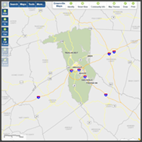
Mapping Applications
News & Updates
2026 is now the default basemap imagery for the Mapping Application.
Did you know?
Clicking the at the top of each tool in the
mapping application takes you to the relevant section of the Help guide.
NEW: We’ve launched Greenville County Maps, our updated mapping application
with a modern interface and improved performance. The Advanced Internet Mapping System remains available and
will continue to be supported during the transition. We encourage users to begin using Greenville County Maps for
the best experience.
A detailed User's Guide for the Mapping Application is available under the Help
menu above or from "Help" in the application menu.